The Dalton Highway part 1

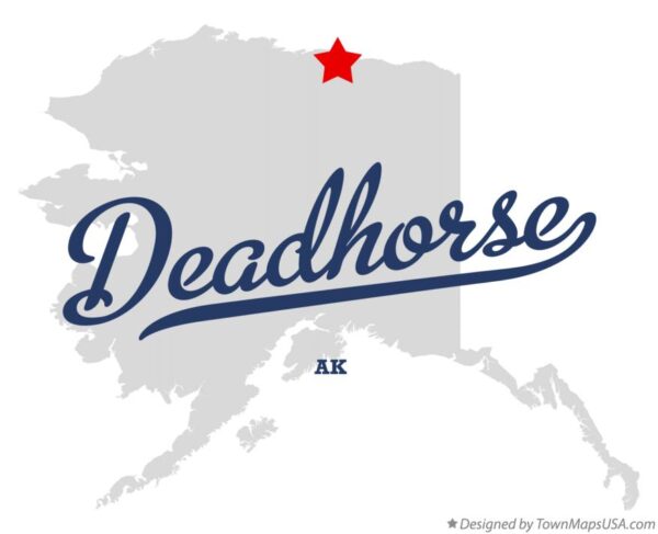
Tucked away in North America is a remote destination seldom visited—or more precisely, rarely reached by vehicle. Known by two names, Deadhorse and Prudhoe Bay, Alaska, this place isn’t quite a town but a unique location at the continent’s northernmost tip, marking the furthest point accessible by road. It’s also the only spot in the United States where you can wade into or even swim in the Arctic Ocean—more on that later. Prudhoe Bay is named after the bay on Alaska’s North Slope, where oil was discovered in 1968, sparking the creation of a camp to start drilling operations.
The first company contracted to haul equipment to Prudhoe Bay was Deadhorse Haulers. After their contract ended, they left trucks and gear behind because returning them via the “Haul Road” was too expensive. New arrivals saw trucks marked Deadhorse, and over time, the camp itself adopted that name.
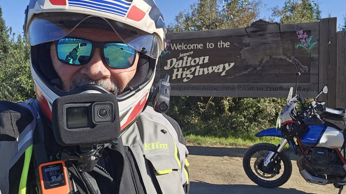
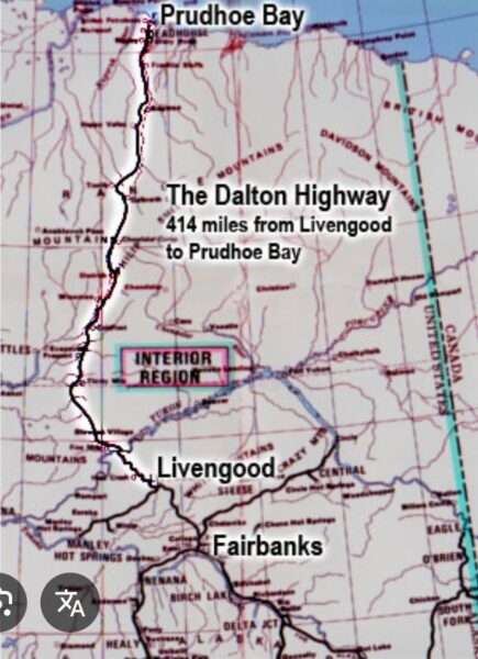
So, how does one get there? For those driving or motorcycling, there’s only one route: the James Dalton Highway, also called the Haul Road—or perhaps it should be nicknamed, “Are you sure you want to ride this?” or “This road will challenge you like no other.”
If you’ve watched Ice Road Truckers or documentaries about the world’s most dangerous roads, you’ve likely seen the Dalton Highway. The official road begins in Livengood, Alaska, about 100 miles north of Fairbanks. Originally called “The Haul Road,” truckers dubbed it the Kamikaze Trail due to its perilous conditions—potholes the size of tires, a mix of gravel and dirt, and constant traffic from speeding trucks—making it a grueling yet thrilling drive. Opened to commercial traffic in 1974 mainly to serve the Alaska Pipeline and deliver equipment to Deadhorse for drilling, the road stretches nearly 500 miles one way. In 1981, it was partially opened to the public up to mile 211, less than half the journey on dirt. By 1994, the entire road was accessible to the public and renamed The James W. Dalton Highway.
Back in the early 1980s, I discovered my passion for reading maps. When I saw the Haul Road map in National Geographic, I knew it was a place I had to visit. I was just beginning my motorcycling journey and thought, why not ride from Massachusetts to Alaska? It just took me 40 years to make it happen!
The road itself is built for one type of vehicle: big trucks! Many websites remind travelers that trucks have the right of way here. Each year, motorcycles, camper vans, and cars attempt the Dalton, but not all reach the end. Approaching hills like Beaver Slide, Roller Coaster Hill, and Gobblers Notch, it almost feels like the highway is asking, “Are you sure you want to be here? It’s okay to turn back now!”
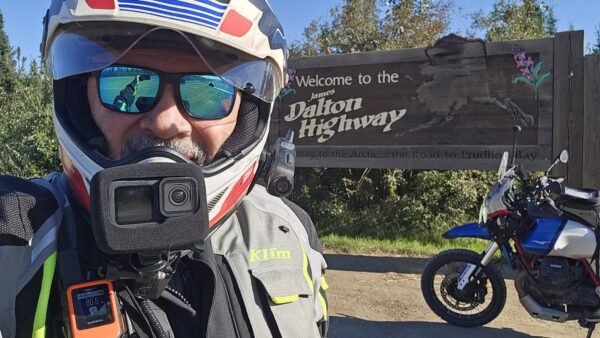
Years of planning, reading, watching videos, and talking to those who traveled the route prepared me for the challenges ahead. Still, I was determined to visit and experience it. While many dream of trips to Hawaii’s beaches or touring Europe, my dream was to ride to Alaska and conquer the Dalton.
Many riders start the road only to turn back at Coldfoot or suffer breakdowns or accidents requiring a tow back to Fairbanks. Conditions can change instantly, and even in good weather, the road is dangerous. Just weeks before my arrival, a mid-July snowstorm dropped a few inches of snow, causing several accidents. One was an experienced adventure rider who crashed and needed a life flight in a Blackhawk helicopter to Fairbanks. When I began the road and climbed the first dirt hill, the first southbound truck I saw carried a mud-covered BMW GS on its back, rescued from this unforgiving terrain. Voices in my head whispered, “Are you sure this is a good idea?”
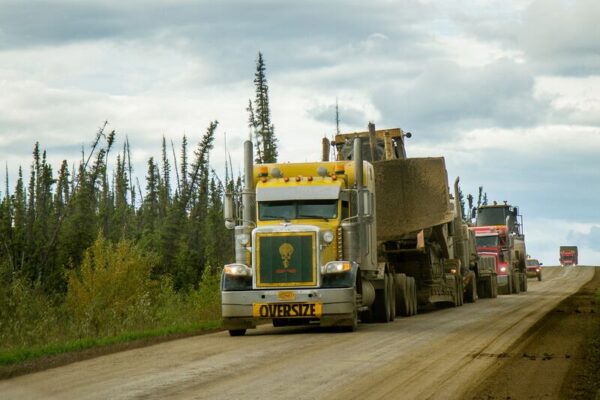
Then came the trucks—massive vehicles hauling heavy loads. On sunny days, like my two days heading north, a thick cloud of dust and rocks trails behind them, blinding you for about 15 seconds while traveling at 45 mph on gravel—a truly terrifying experience. Many truckers slow down and move to the road’s edge to reduce the dust cloud, a kindness I deeply appreciated.
Another unique aspect of this journey was encountering the calcium chloride sprayed on the road to suppress dust. It works well but creates a surface as slippery as a frozen New England sidewalk in February. I wasn’t sure which was scarier—the dust or the slick roads.
At mile 56 on the Dalton, you reach the mighty Yukon River and the fascinating E. L. Patton Bridge, a wooden deck bridge with a 6% grade stretching about half a mile. Just north of the bridge is the first fuel, food, and lodging available—fuel up here, as the next station is 125 miles away. Before reaching Coldfoot, you cross the Arctic Circle, marked by a rest stop and campground for those needing to rest overnight.

The stretch between the Yukon River and the Arctic Circle was in the worst condition during my trip, with extensive construction, deep gravel patches, and daunting hills made even more challenging by thick dust clouds from passing trucks. At one point, descending Beaver Slide behind two RVs kicking up so much dust I could barely see their brake lights, with an 18-wheeler close behind, I realized I couldn’t pass or pull over—I was at the mercy of the gravel gods to survive that hill!
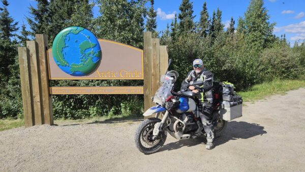
After stopping for photos at the Arctic Circle sign, I continued north. From there to Coldfoot, traffic thinned considerably, suggesting many turn back after crossing the Arctic Circle. I was pleasantly surprised to find a few miles of pavement here, though rough and dotted with potholes the size of small vehicles.
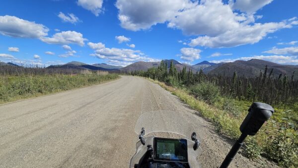
Just as quickly as the road shifted from dirt to bumpy pavement, it returned to gravel. Once again, I encountered the wonders of calcium chloride, or rather, the slippery layer it creates on the gravel to keep dust down. This is also where lots of the scenic views start to appear and I found myself stopping for photos and becoming comfortable with the conditions I was riding through.
When I planned this journey, I promised myself that no matter what, I would head north on the Dalton, all the way to the end! No matter the circumstances! Still, I preferred not to ride this treacherous road in the rain. The forecast for the next four days predicted bright sunshine for three days and cloudy skies with a slight chance of showers on the fourth. My first day turned out to be perfect for riding—sunshine with just a few clouds and temperatures in the high 60s.
I arrived at Coldfoot Camp around 3 p.m., tired, hungry, and covered in dust. My first day on the Dalton was nearly over, but I needed to refuel both my Guzzi and myself at the only spot in town. Is it really a town? I suppose so—with a population just over 300 as of 2025. Lodging options include a row of trailers across the dusty parking lot from the fuel station and restaurant, or a small patch of crabgrass and weeds where you can pitch a tent for free. I had read reviews of both and knew I didn’t want to stay at either. In fact, I left all my camping gear back in North Pole for this trip, aiming to travel light on the big goose. I might regret that choice later, but we’ll get to that soon!
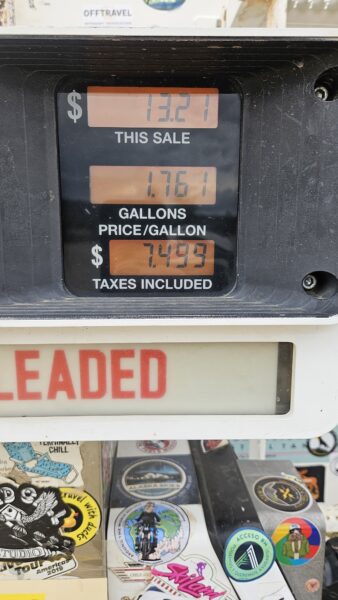
After filling the bike with $8-a-gallon fuel and enjoying the famous Coldfoot Camp burgers, I quickly covered the last few miles for the day, reaching Wiseman, Alaska—the final town before Deadhorse. With a population of just 24 and one small lodge, it was the perfect place to rest. Day one of the Dalton was complete. I had dreamed of this road and this ride for so long, and the excitement of finally experiencing the mighty Dalton was overwhelming.
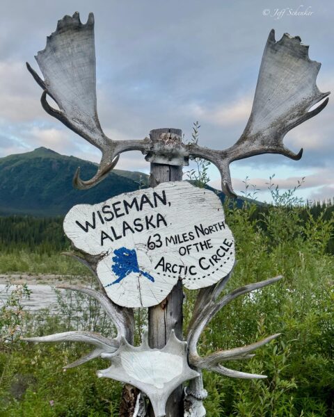
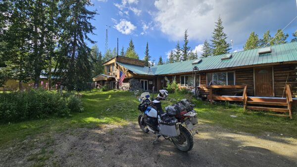
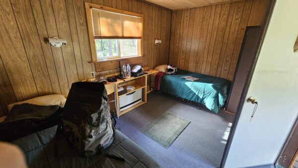
Tomorrow, we head north—245 miles between fuel stops. The Atigun Pass and the Arctic Tundra await, but tonight, I sleep like the dead!